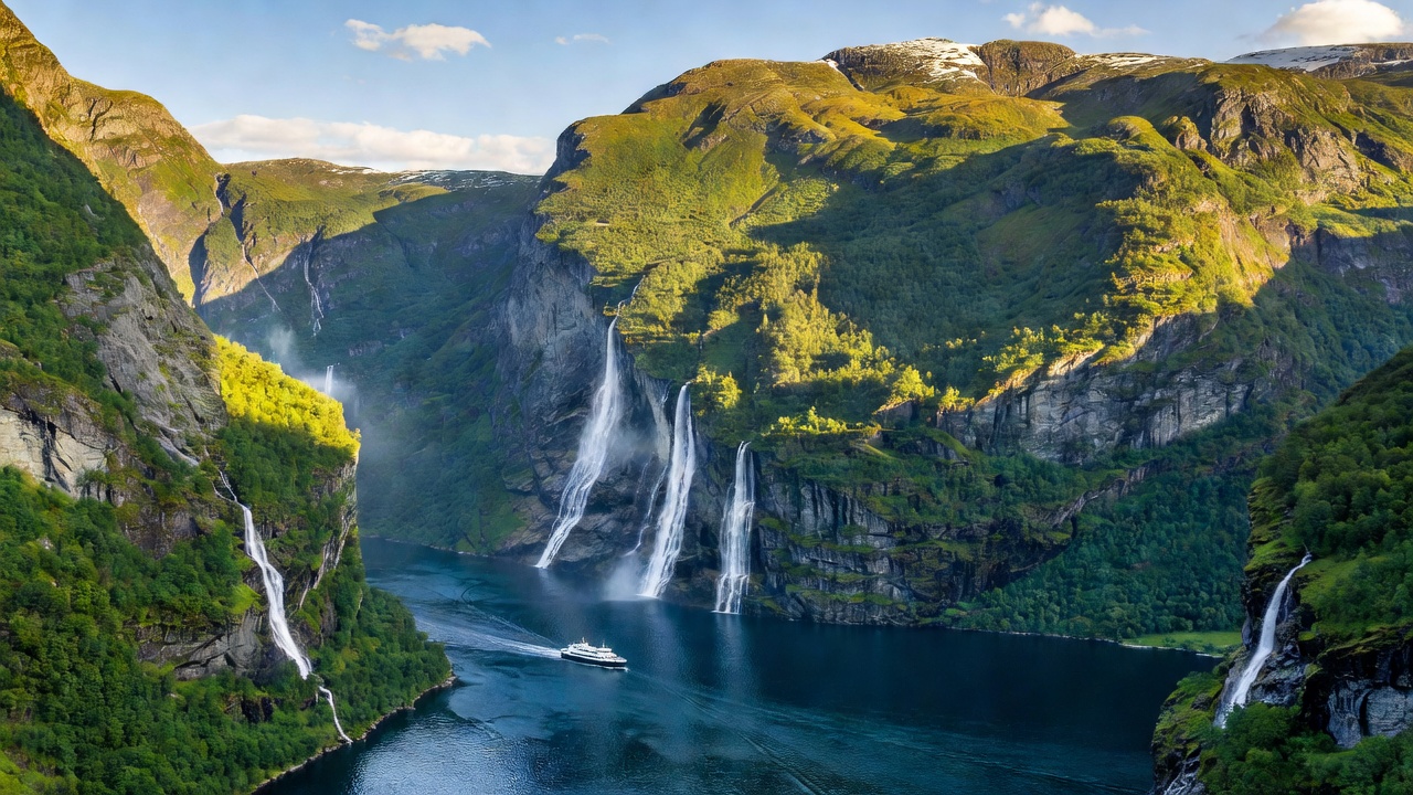
Five Fjords Side by Side
Western Norway's fjords run from the Lysefjord near Stavanger north to Geirangerfjord in Møre og Romsdal. Bergen sits roughly in the middle and is the practical gateway for most first trips. The table gives the headline differences before the detail.
| Fjord | Length | Typical base | Signature sight | Best for |
|---|---|---|---|---|
| Geirangerfjord | About 15 km | Geiranger, Hellesylt | Seven Sisters waterfall, Dalsnibba viewpoint | Viewpoint drivers, families |
| Nærøyfjord | About 17 km | Gudvangen, Flåm | Walls closing to about 250 m apart | Kayakers, boat trips |
| Sognefjord | About 204 km | Balestrand, Lærdal, Flåm | Urnes Stave Church, Flåm Railway | Road-trippers, cyclists |
| Hardangerfjord | About 179 km | Ulvik, Lofthus, Odda | Trolltunga, Vøringsfossen, orchards | Hikers, cider lovers |
| Lysefjord | About 42 km | Stavanger | Preikestolen, Kjeragbolten | Day hikers from a city base |
Geirangerfjord and Nærøyfjord: the UNESCO Pair
UNESCO lists these two together as the West Norwegian Fjords. Geirangerfjord is short and dramatic: the Seven Sisters waterfall faces the Suitor (Friaren) across the water, and abandoned clifftop farms such as Skageflå cling to ledges above. The Geiranger–Hellesylt car ferry is the best low-effort way to see it from the water. By road, the Eagle Road (Ørnevegen) hairpins and the toll road up to Dalsnibba, around 1,500 m above sea level, give the overhead view.
Nærøyfjord, an arm of the Sognefjord, is narrower and quieter. Its walls rise up to about 1,700 m, and at its tightest it is roughly 250 m wide. Boats run between Gudvangen and Flåm, and the calm water makes it Norway's most popular fjord for guided kayak trips.
Sognefjord: Length and Depth
Norway's longest fjord runs about 204 km inland and plunges to about 1,300 m at its deepest. It is less one view than a corridor of side arms: Fjærlandsfjord leads to glacier country around Jostedalsbreen, Lustrafjord holds Urnes Stave Church, a UNESCO site since 1979, and Aurlandsfjord leads to Flåm. The Flåm Railway climbs about 863 m over 20 km to Myrdal. The Lærdal Tunnel, at 24.5 km the longest road tunnel in the world, links the region east toward Oslo.
Hardangerfjord: Orchards and Big Hikes
At around 179 km, Hardanger is Norway's second-longest fjord and its softest-looking one. Apple and cherry orchards line the slopes near Lofthus and Ulvik and flower in May. Odda is the base for Trolltunga, a long day hike of roughly 10 to 12 hours return that rewards preparation, not improvisation. Vøringsfossen drops about 182 m into the Måbødalen valley, with newer footbridges and viewing platforms at the top.
Lysefjord: The City Fjord
Stavanger puts the Lysefjord within an hour or two. Preikestolen (Pulpit Rock) sits about 604 m above the water and is a moderate hike of around four hours return. Kjeragbolten, the boulder wedged in a crevice near the fjord's inner end, is a harder outing. Flørli, reached by boat, has a wooden staircase of 4,444 steps beside an old hydropower pipeline.
Who Each Fjord Suits
- Hikers: Hardanger for Trolltunga, Lysefjord for Preikestolen and Kjerag, Geiranger for farm trails.
- Sailors and paddlers: Nærøyfjord for kayaks. Fjords give shelter but deep water means few anchorages, and katabatic winds can funnel down valleys.
- Families: Geiranger by car and ferry, Flåm by rail and boat. Short walks, big views, little risk.
Getting Around and Crowd Notes
Car ferries cross almost every fjord and are part of the road network. Several of Norway's National Tourist Routes, including Geiranger–Trollstigen, Gamle Strynefjellsvegen and Aurlandsfjellet, cross this region; high sections typically open from late spring to autumn. Cruise ships call at Geiranger and Flåm in summer, and Norway has adopted rules to phase in zero-emission requirements for ships in its World Heritage fjords. For quieter water, arrive early, stay overnight, or choose late May and September.
Fjord Fact Blocks
Why are fjords so deep?
Glaciers eroded hardest where ice was thickest, inland, then left a shallower sill at the mouth as they thinned toward the sea.
Are fjords salt water?
Yes, though a fresher surface layer from rivers and meltwater can sit on top, which is why inner fjords often look green.
Can you swim in them?
In July and August, yes, briefly. Surface water warms in sheltered bays but stays cold just below.