Three Island Groups Compared
| Group | Main access | Signature sights | Crowd level in summer | Best for |
|---|---|---|---|---|
| Lofoten | Bodø–Moskenes ferry, Svolvær, Leknes airport | Reine, Hamnøy, Henningsvær, Nusfjord | High | Hikers, photographers |
| Vesterålen | E10 from Lofoten, Stokmarknes, Andenes | Whale safaris, Trollfjord, Bleik | Moderate | Wildlife, families |
| Senja | Bridge at Finnsnes, ferry from Tromsø area | Segla, Bergsbotn, Husøy, Tungeneset | Low to moderate | Hikers, road-trippers |
Lofoten: Peaks, Cod and Cabins
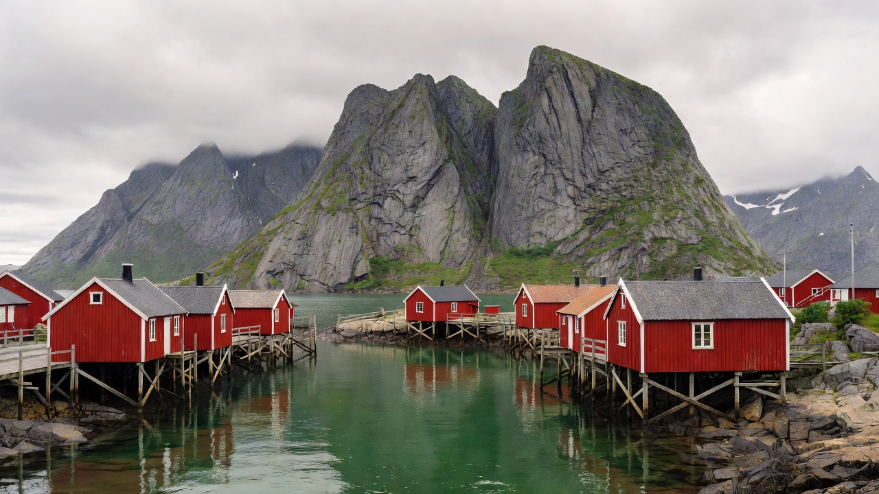
Lofoten stretches southwest into the Norwegian Sea at roughly 68° north. The E10, known here as King Olav's Road, links the islands from the mainland to the village of Å at the southern tip. Western Lofoten holds the postcard scenes: Reine, Hamnøy and Sakrisøy with their red rorbuer, and Nusfjord, one of Norway's best-preserved fishing villages. Henningsvær, further east, is known for its football pitch on a rocky islet.
Cod built Lofoten. From roughly January to April, migrating skrei cod arrive to spawn, and the wooden drying racks for stockfish fill. At Borg, the Lofotr Viking Museum reconstructs a chieftain's longhouse about 83 m long on an excavated site.
Hikes are short but steep. Reinebringen, above Reine, now has a stone staircase built by Nepalese Sherpas. Ryten overlooks Kvalvika beach, and Festvågtind rises above Henningsvær. Weather changes fast, so treat even short routes seriously.
The car ferry from Bodø to Moskenes takes roughly three to four hours. Hurtigruten coastal ships call at Stamsund and Svolvær, and there are short flights from Bodø.
Vesterålen: Whales and Quiet Roads
Vesterålen sits directly north of Lofoten, with similar mountains and far fewer visitors. Andenes, on Andøya, is the base for whale safaris; the Bleik Canyon offshore brings deep water close to land, and sperm whales feed there. Bleiksøya, a bird cliff near the village of Bleik, holds a large puffin colony in summer. Stokmarknes is where Richard With founded the Hurtigruten coastal route in 1893, now told in the Hurtigruten Museum.
The Trollfjord, between Lofoten and Vesterålen, is around 2 km long with an entrance only about 100 m wide. Larger ships and small boats make the run in season.
Senja: Norway's Second-Largest Island
Senja is the largest island in mainland Norway after Hinnøya. Its outer coast faces the open sea with jagged peaks, while the inner side is gentler farmland and forest. Segla, a fin-shaped summit of 639 m, is the signature hike, with the neighbouring Hesten ridge giving the classic view of it. The National Tourist Route Senja links viewpoints at Bergsbotn and Tungeneset. Husøy, a fishing village on its own islet, is joined by a causeway. Ånderdalen National Park protects coastal pine and birch forest.
A summer ferry between Andenes and Gryllefjord links Vesterålen with Senja, making a one-way road trip from Lofoten to Tromsø possible.
Light: Midnight Sun and Northern Lights
In Lofoten the midnight sun runs roughly from late May to mid-July; Senja, slightly further north, gets a little longer. In midwinter the sun stays below the horizon for several weeks, though twilight brings soft blue light at midday. Northern lights are visible from about September to March on clear, dark nights.
Who Each Group Suits
- Hikers: Lofoten for variety, Senja for fewer people on the trail.
- Sailors: experienced crews only; open-sea exposure and strong tidal currents, such as the Moskstraumen near Å.
- Families: Vesterålen for whale trips and beaches; Lofoten's village museums.
Arctic Fact Blocks
What is a rorbu?
A fisherman's cabin on poles at the water's edge, originally used by seasonal crews during the cod fishery.
What is the Moskstraumen?
A powerful tidal current off the southern tip of Lofoten, one of the strongest in the world and the inspiration for the maelstrom in literature.